Highway 128
THIS ROAD LESS TRAVELED IS A JOURNEY WORTH TAKING
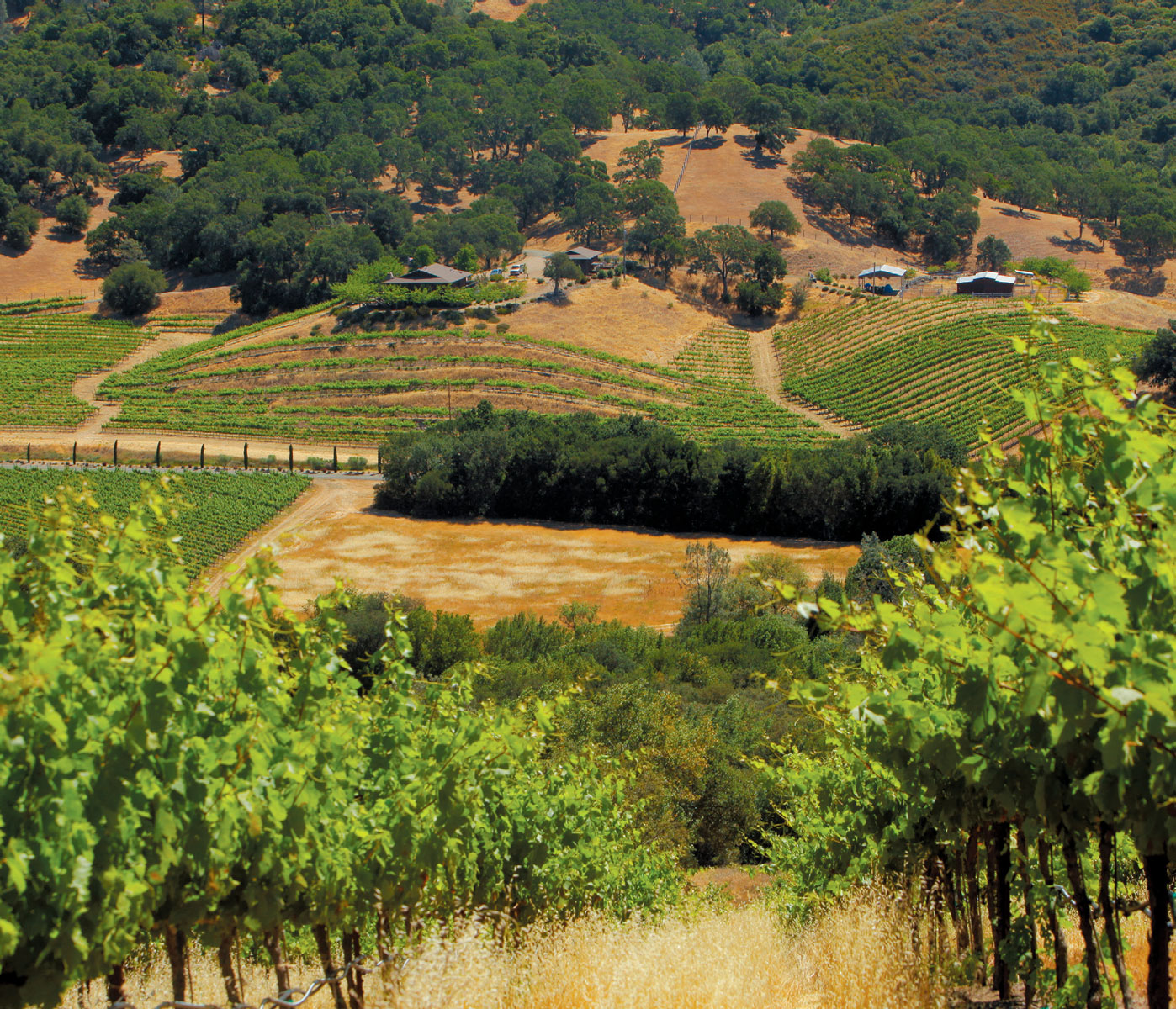
Highway 128 is a scenic stretch of 140 miles that crosses through four of California’s wine-producing counties— Yolo, Napa, Sonoma and Mendocino—and some of the most intriguing scenery in the state.
The state highway runs from the western edge of the great Central Valley over ranges and through valleys, all the way to Highway 1 and the Pacific Ocean. The scenery includes lakes, rivers, redwoods, serpentine ridges, tectonic plate uplift s, oak savannah and digger pines. The whole route, which is a dramatic slice of California landscape, is lined with many, many wineries, plus breweries, bucolic orchards and farms and grazing cattle. All along the route there are restaurants for every taste, from haute to humble.
Sadly, today the route also displays hillsides of charred grass and trees from recent fires, but the landscape and its underlying drama are undiminished.
Highway 128 enters Napa Valley from the east on Silverado Trail. From there it crosses the valley to such iconic wineries as St. Supery, Cakebread and Robert Mondavi. It turns north and runs with Highway 29 before leaving the valley above Calistoga, climbing over the Mayacamas into Knight’s Valley and continuing to the west and the Pacific Ocean.
However, the turn less taken, back to 128 East, has its own different reveals. The luxury resort Auberge de Soleil and the vineyards on the valley floor are quickly left behind as Sage Canyon Road twists into the hills, following Conn Creek back to Conn Dam and peaceful Lake Hennessy. With easily accessible boat ramps, it’s an easy launch for fishermen angling on the lake’s placid waters. There are several wineries near the lake and just beyond—Gandona, Chapellet, David Arthur, Neyers and Kuleto Estate—but visiting them requires a prior appointment.
After Lake Hennessey, the road follows Clear Creek up a long, long grade to the summit, then down along Sage Creek, plunging back into oaks and manzanita, towards Lower Chiles Valley.
A few miles on, just west of Lower Chiles Valley, is the Nichelini Winery, the oldest continuously operated family-owned winery in Napa County. The founder, Anton Nichelini, came from Switzerland in the 1880s, learned winemaking in Sonoma and homesteaded in Napa. Before he was a winemaker he supplied meals to the miners who worked in the magnesite mines in the area in the late 1800s. Nichelini’s grapes are sourced from family vineyards in Chiles Valley at 600 to 800 feet above the Napa Valley floor. The tasting room is located in the old family home, but on most days tasters can be found in the spacious, shaded backyard area with plenty of picnicking facilities and a bocce court. Parking can be tricky since the road is narrow, but areas have been carved out to accommodate visitors.
From here, the road begins to cross Lower Chiles Valley, back into grapevines, and it climbs to the top of the grade and to the dramatic gated entrance of the spectacular Somerston Estate. The vineyards spread over two historic properties, the Priest Ranch and Elder Valley, and cover the valley floor and smaller hills, then rise up to the mountaintop, a substantial elevation range. At the back of the property, west of Sugarloaf Peak, is where the Priest Mine, a magnesite mine, was located over a hundred years ago. Visiting is by appointment only, but the well planned visitor will be rewarded with stunning views, hillsides of grazing sheep, a private lake and a welcoming tasting room.
Sage Canyon Road continues down through digger pines and serpentine rocks. Just past the intersection with Knoxville Road is Turtle Rock Bar and Café, a roadside icon known locally, oddly enough, for its egg rolls, but there is also ample cold beer and atmosphere, and it seems just the right spot for an oasis of cheer in sparse surroundings.
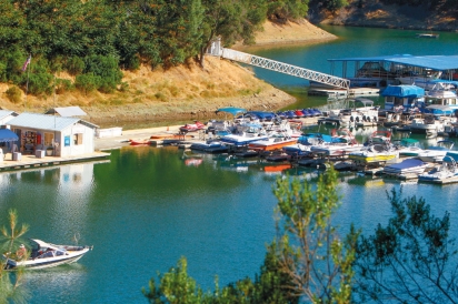
Sage Canyon Road is now Capell Valley Road as Highway 128 follows Capell Creek into Capell Valley, which is kind of a mixture of vineyards and horse and cattle ranches. Near the eastern end of Capell Valley, Highway 121 comes in from downtown Napa. Highway 121 is also Monticello Road here, the road over the hills from Napa to the town of Monticello that once sat amid the expansive grain farms and cattle ranches of Berryessa Valley. Monticello Dam was built on Putah Creek in the mid 1950s and the remnants of the town and outlying ranches went deep under the waters of Lake Berryessa when the lake completely filled the valley in 1963.
From there, the highway continues east about three miles through rolling hills dotted with huge oak trees draped with gray-green Spanish moss and then swings around to the north and starts to climb the ridges to approach the western reaches of Lake Berryessa.
Fishing and swimming coves are tucked here and there amidst great views of the lake, and at Markley Cove Resort you can rent boats or launch your own.
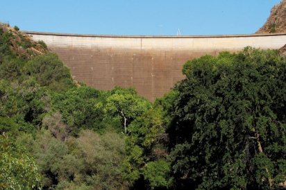
Just farther on, it is worth stopping at Monticello Dam where there is ample parking to get out and view the lake and the striking rock formations. At Monticello Dam, the dramatic uplift of towering, near-vertical rock geologically illustrates two tectonic plates meeting. The ridgeline rocks are the Venado Formation, a massively bedded sandstone tilted almost vertically and 91 million years old, formed when the Pacific ocean floor plate pushed against and went under the North American continental plate, also creating the Vaca and Blue Ridge mountain ranges.
Also impressive is “the Glory Hole,” an uncontrolled spillway next to the dam, essentially a huge concrete pipe 72 feet across anchored on the reservoir floor to catch rising waters. The lake level only rises to the Glory Hole level every few years (in a very wet winter), but it is almost frightening to watch thousands of gallons of water pouring silently over the rim of the now-submerged pipe before booming out of the foundation of the dam into Putah Creek and the canyon below. When the Glory Hole is overflowing, people gather from all over Northern California to see the spectacle.
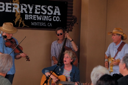
Back on Highway 128, the road now drops away from lake level and follows Putah Creek past several fishing accesses for catch-and- release trout and with tables and benches for picnicking, then makes its way out of the canyon into the westernmost edge of the Sacramento Valley. Walnut and prune orchards and vineyards line the highway before arriving at the old Tufts Ranch Packing Shed, now home to Berryessa Brewing Company and Berryessa Gap Vineyards tasting room. Open to the public Thursday through Sunday, the craft brewery and winery tasting room share a vast covered patio and bandstand where crowds of people young and old are drawn to live music, food trucks and, of course, the housemade beverages.
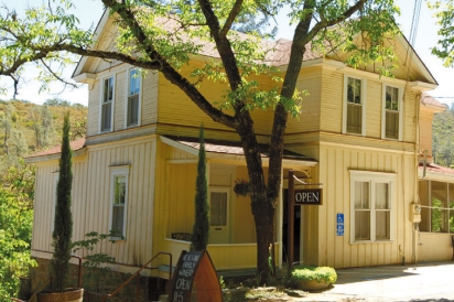
Highway 128 continues on to Winters, where it terminates at Highway 505. However, if you are loathe to end your journey, a right turn on Railroad Avenue before reaching the 505, past Pisani’s Highway 128 Gas Station, will bring you to Main Street, the core of Winters’ small downtown. There you will find Turkovich Family Wines tasting room, a second Berryessa Gap tasting room, the famous Buckhorn Steakhouse and more cafés and restaurants with outdoor chairs and tables.
The fall is a great time to explore these roads less traveled, where you can enjoy the beauty of harvest time in Wine Country, far from the madding crowds. It’s a bit like stepping back in time.